
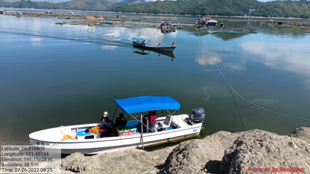
Ramon, Isabela – The Integrated Flood and Water Resources Management in ASEAN Basins for Sustainable Development (IFWARM) staffs of the Isabela State University (ISU), along with the Flood Forecasting and Instrumentation Section (FFIS) staffs from the National Irrigation Administration – Dam and Reservoir Division (NIA-DRD) conducted a bathymetry survey as well as velocity and turbidity measurements which begins on July 26.
With the conduct of the survey, the underwater features of a water body can be determined as well as the depth of a water body. For many various sorts of research, including flood inundation, contour of streams and reservoirs, leakage, scour, and stability, water-quality studies, dam removal, biological and spill, and storage and filling up of reservoirs and ponds, bathymetric surveys can be utilized. The said team was scheduled for a two-week data gathering and measurements, the team finished Ranges 1 – 4 on the last week of July and is expected to finish surveying the main reservoir on August 5 respectively.
The measured sedimentation data will be used to assess the current rate of sedimentation in the reservoir. Sedimentation limits the capability for energy production, storage, discharge, and flood attenuation, as well as the safety of dams. It puts more strain on the dam and gates, harms mechanical components, and has a variety of negative effects on the environment.
Additionally, gathered velocity and turbidity values will be gathered for the calibration and validation of the 2D and 3D Hydro-morphodynamical models of the reservoir. It can be noted that the IFWARM project aims to develop new, cutting-edge models and techniques for integrated flood, sediment, and water resources management for the major river basins in the Philippines along with Vietnam, and Japan. As a prerequisite, Bathymetry surveys are necessary as pre-assessment work and data gathering activity.


 Users Today : 39
 This Year : 481
 Total Users : 1366
 Views Today : 58